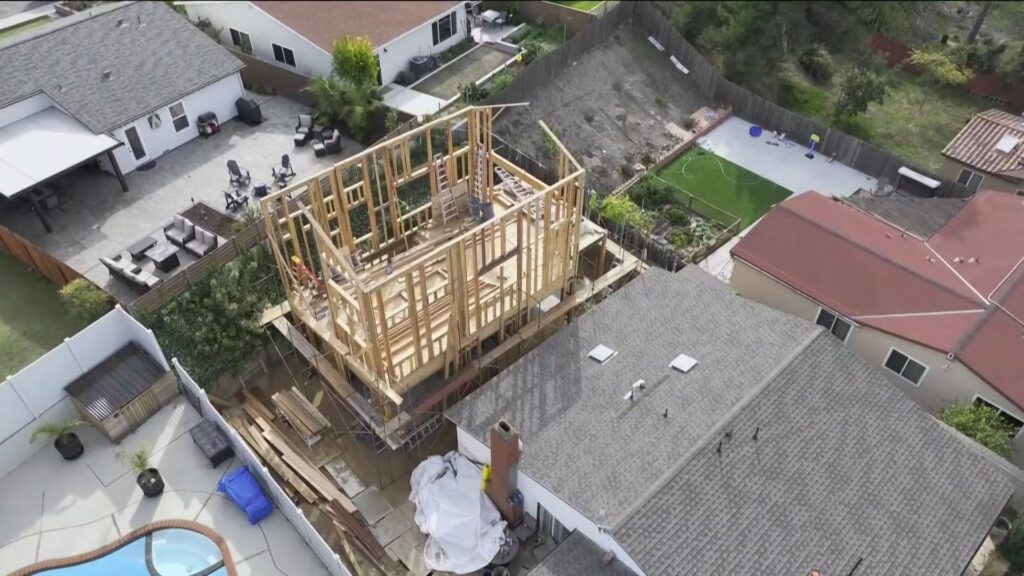

Most homeowners assume the floor plan is the document that makes or breaks an ADU permit. It isn’t. Long before a reviewer cares whether your bedroom is the right size, they’re checking whether the unit even belongs where you’ve drawn it, and that question gets answered entirely by one page: the site plan. Get the ADU site plan requirements wrong, and it doesn’t matter how polished the rest of your drawing set is. The application stalls before anyone even looks at your interior layout.
A site plan, sometimes called a plot plan, is the bird’s-eye drawing that shows your lot, your existing house, your proposed ADU, and everything in between: property lines, setbacks, driveways, utilities, and site conditions that could affect the build. It’s the single most common source of permit delays, and it’s also one of the easiest documents to get right once you know exactly what a reviewer is looking for. This guide walks through what belongs on it, what agencies commonly ask for beyond the basics, and the mistakes that send plans back for another round.
Why the ADU Site Plan Controls Everything Else
Before a plan checker evaluates your floor plan, your elevations, or your structural details, they need to confirm the project is even allowed to exist in that location. That’s what the site plan proves. It demonstrates that your ADU sits outside required setbacks, doesn’t conflict with an easement, has legitimate access for construction and emergency response, and fits within your lot’s allowed coverage.
Think of it as the document that answers “can this be built here at all,” while every other sheet in your permit set answers “is this built correctly.” A floor plan with a beautifully designed kitchen means nothing if the site plan shows the structure four feet into a required setback. That’s why building departments almost universally review the site plan first, and why getting it wrong is the single most common reason ADU applications bounce back for corrections.

The Core Items Every ADU Site Plan Needs
Regardless of which city or county you’re building in, certain elements show up on essentially every jurisdiction’s checklist. Municipal permit guides across the country, from Los Angeles to smaller cities like Turlock, California, consistently require the same foundational set of information, drawn to scale rather than sketched freehand.
Property lines with dimensions come first. Every boundary of your lot needs to be shown with its actual measured length, not an estimate. This is the baseline every other measurement on the page gets checked against.
A north arrow and a stated scale are non-negotiable. Reviewers need to orient the drawing and verify that what’s on paper matches real-world distances, and a site plan without a legible scale usually gets rejected before anyone even measures anything on it.
The adjacent street, and alley if one exists, needs to appear on the plan, since it establishes your front property line and affects how setbacks and access get measured.
Your existing primary dwelling’s footprint has to be shown and labeled with its square footage. This matters for more than just clarity, since many jurisdictions cap ADU size as a percentage of the primary home’s floor area, and a reviewer needs both numbers on the same page to check that math.
The proposed ADU footprint, drawn to scale with its dimensions and total square footage labeled, is the centerpiece of the drawing. This needs to match exactly what’s shown on your floor plan; any discrepancy between the two documents is an automatic correction.
Distances from the proposed ADU to your property lines and to the existing primary dwelling need to be dimensioned directly on the plan, not left for the reviewer to calculate by measuring a scaled drawing themselves. This is where setback compliance actually gets verified, and it’s worth cross-referencing your numbers against our zoning information lookup tool before you finalize anything, since setback requirements vary significantly by jurisdiction and even by zoning subdistrict within the same city.
Any recorded easements crossing the property need to be shown and labeled, since construction can’t encroach into most utility or access easements regardless of how much buildable space appears to be available.
What Agencies Commonly Ask for Beyond the Basics
Once you’ve covered the fundamentals, most jurisdictions layer on additional requirements depending on your specific site and local code.
Driveways and parking areas need to be shown, including their dimensions and surface type, since many cities regulate how ADU parking interacts with existing driveway access.
Utility routes and meter locations matter more than homeowners usually expect. If your ADU is tying into existing water, sewer, or electrical service from the main house, the plan needs to show that connection path. If it’s getting its own separate utility service, the meter location and route need to appear as well.
Site drainage is required on nearly every checklist reviewed, since adding impervious roof and driveway area changes how water moves across a lot, and reviewers need to see that runoff isn’t being redirected onto a neighboring property.
Significant trees, especially any protected or heritage trees under local ordinance, often need to be shown with their approximate canopy, since some jurisdictions restrict construction within a certain radius of a tree’s root zone.
Grade changes and retaining walls need documentation if your lot has any meaningful slope, since a retaining wall above a certain height frequently triggers its own separate structural review.
Fire access requirements come into play on tight lots, particularly where the distance between structures affects required fire separation or where a fire truck needs a clear path to reach the rear of the property.
Septic systems, wells, and their required setback distances need to appear on the plan for any property not connected to municipal water and sewer, since these systems typically carry their own separation requirements from any new structure.
Flood zone or wildfire overlay designations, where applicable, may require additional notation or an entirely separate compliance document depending on your jurisdiction’s specific overlay requirements.

ADU Site Plan, Survey, and Grading Plan: Three Different Documents
A common point of confusion is treating “site plan,” “survey,” and “grading plan” as interchangeable. They’re related, but they serve different purposes, and some jurisdictions require more than one.
A site plan is the planning-level drawing described above: a to-scale representation of your lot showing the existing and proposed conditions relevant to your permit.
A property survey is a legally certified document, prepared by a licensed surveyor, that establishes your actual property boundaries based on recorded deed records and physical monumentation. Your site plan should be based on survey data, but the survey itself is a distinct, often more expensive document that some jurisdictions require to be submitted separately or referenced directly.
A grading plan focuses specifically on elevation changes, drainage patterns, and earthwork, and it’s typically required as a standalone document when your ADU involves significant regrading, a retaining wall, or a lot with slope steep enough to affect drainage patterns beyond what a basic site plan drainage note can capture.
Whether your jurisdiction requires one, two, or all three of these documents depends entirely on local code and your specific site conditions, which is exactly why a one-size-fits-all site plan template found online often falls short of what your city actually needs.
How to Measure Setbacks Correctly
Setback distances sound simple until you’re actually standing on your lot trying to figure out where the measurement starts and ends. The local ordinance defines the exact measurement method, and it’s not always as intuitive as “distance from the property line to the wall.”
Some jurisdictions measure from the property line to the nearest point of the structure, including roof eaves and overhangs, while others measure only to the foundation or exterior wall and treat eaves separately with their own allowed encroachment. Corner lots often have a different setback requirement on the street-facing side than a standard side yard. And height matters too: several cities apply a smaller setback to single-story structures and a larger one once a structure exceeds a certain height threshold.
Rather than assuming a national standard applies to your project, confirm the exact measurement method and required distances for your specific zoning district before finalizing your site plan. This is precisely the kind of detail that varies enough by city that guessing wrong is one of the most common reasons a plan gets bounced back.

Common Site Plan Mistakes That Cause Resubmittals
A handful of errors show up constantly across ADU permit rejections, and most of them are avoidable with careful review before submission.
Missing dimensions top the list. A site plan that shows a setback visually but doesn’t label the actual measured distance forces a reviewer to guess or reject the drawing outright, since they’re not permitted to approve based on an estimate.
Conflicts with recorded easements happen when a homeowner works from an outdated property record or an informal fence-line sketch instead of an actual survey, only to discover during review that a utility easement crosses exactly where the ADU was planned.
Incorrect or missing scale makes an otherwise complete drawing unusable, since reviewers need to verify dimensions against the drawing itself, not just trust the labeled numbers.
Failing to show existing structures, sheds, decks, or even significant trees that a city tracks, is a frequent oversight that becomes a correction item once a reviewer cross-references your site plan against aerial imagery or a prior permit record for the property.
A mismatch between the site plan footprint and the floor plan footprint is one of the most common single corrections issued on ADU projects. If your floor plan shows a 720-square-foot unit but your site plan labels it at 700, that inconsistency alone typically triggers a full correction cycle.
When a Professional Survey Is Worth the Cost
Not every ADU project needs a fresh, licensed survey, but several situations make one worth the expense rather than relying on an old plat map or an informal measurement.
Older property records are the most common trigger. If your lot’s last recorded survey predates significant neighborhood changes, fences, additions, or boundary disputes, the paper record may no longer reflect reality on the ground.
Irregular lot shapes- anything beyond a standard rectangle- make it genuinely difficult to calculate accurate setbacks and buildable area without precise boundary data.
Any uncertainty about where your actual property line sits, particularly along a fence that may not match the recorded boundary, is worth resolving before you design around an assumed line rather than a surveyed one.
Alley access, steep terrain, and any addition to an already-complex site all raise the stakes of a measurement error enough to justify professional survey work.
And if your planned ADU sits close to a setback line, close enough that a few inches of error could push you into violation, that’s exactly the scenario where a certified survey pays for itself by avoiding a rejected permit or, worse, a built structure that turns out to be out of compliance.
Getting Your Site Plan Permit-Ready
A permit-ready ADU site plan isn’t complicated once you know what belongs on it, but it does require precision that a rough backyard sketch simply can’t deliver. Confirm your zoning district’s specific setback and coverage rules first, work from an accurate survey rather than a guess, and make sure every dimension on your site plan matches what appears on your floor plan before you submit.
If you’re still early in planning and want to see how a design fits your lot’s actual constraints, our AI ADU design advisor can help you test layout options against realistic setback and coverage limits before you pay for formal drawings, and our contractor license lookup tool is a useful next step once you’re ready to bring in a surveyor, designer, or contractor to finalize a permit-ready plan.